Sikkim

Sikkim

Sikkim is a state in northeast India, bordered by Bhutan, Tibet and Nepal. Part of the Himalayas, the area has a dramatic landscape that includes India’s highest mountain, 8,586m Kangchenjunga.Sikkim's tiny size geographically belies the profound diversity she offers. The state has the steepest rise in altitude over the shortest distance and has within its 7,096 sq. kms the entire climatic range, from tropical to temperate to alpine, bestowing on the land an intense natural heritage. Lush and thick forests, flush with blooms of exotic flora, hilly expanses embellished by Sikkim's two main rivers, the Teesta and the Rangeet, the picturesque villages, hot springs and waterfalls have a compelling appeal.

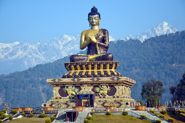
About 45 minutes drive from Gangtok, 24 kms. away, is the Rumtek Dharma Chakra Center, the seat of the Kagyu order, one of the 4 major Tibetan Buddhist sects. Since the late 1960's, after the arrival of His Holiness the 16th Gyalwa Karmapa, the center houses some of the world's most unique religious scriptures and religious art objects. Traditional in design, it is almost a replica of the original Kagyu headquarters in Tibet.

iSikkim

Tshangu Lake

It is literally known as "source of the lake " in Bhutia language. Just about 40 kms. away from Gangtok, the capital of the state, this serene lake is situated at an altitude of 12,000 ft on the Gangtok Nathu La highway. It falls in the restricted area and hence an inner line permit is required by Indians to visit this place. Foreign nationals are not permitted to visit this lake without special permission. The lake is about 1 km. Long, oval in shape, 15 meters deep and is considered sacred by the local people.

iSikkim

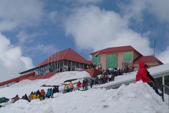
Nathula Pass

It connects the Indian state of Sikkim with China's Tibet Autonomous Region. The pass, at 4,310 m (14,140 ft) above mean sea level, forms a part of an offshoot of the ancient Silk Road. Nathu means "listening ears" and La means "pass" in Tibetan.[1] On the Indian side, the pass is 54 km (34 mi) east of Gangtok, the capital of Indian state of Sikkim on JN Marg and only citizens of India can visit the pass, that too after obtaining a permit in Gangtok.

iSikkim

Tashi View Point

Situated along the North Sikkim highway it is only 8 kms. from Gangtok. From this point you get a breathtaking view of Mount Khangchendzonga and Mt. Siniolchu, one of the most graceful peaks in the world.

iSikkim

Ravangla

At the base of Maenam Hill is Ravangla, a small township and transit to various tourist destinations in South Sikkim and West Sikkim . It is also an upcoming tourist spot, and transit point for trekkers to Maenam Hill and Borong. There are accommodation facilities and numerous short nature trails. A trek down to the sacred cave "Shar Chok Bephu", one of the holiest caves in Sikkim.

iSikkim

Yumthang Valley

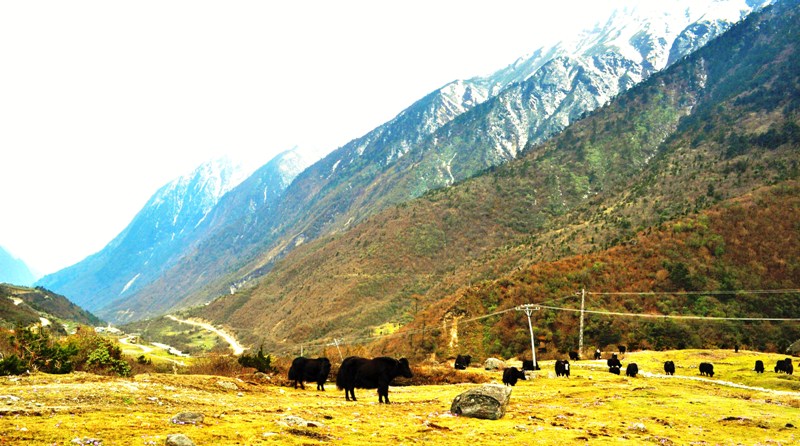
Yumthang, at an elevation of 11,800 ft. & 140 kms. from Gangtok, is a paradise for nature lovers with a fascinating blend of flora & fauna and breathtaking scenic grandeur. Yumthang "Tsa-Chu" or the hot spring on the left bank of Lachung Chu is immensely popular for its curative and healing power. Covered with rhododendron shrubs and trees, the entire valley erupts into a riot of colors in May. Lachung, a quaint village which has its own unique beauty and lifestyle. On the way to Lachung is Singhik where one can see the magnificient Kanchendzonga range in its splendour.

iSikkim

Ropeway

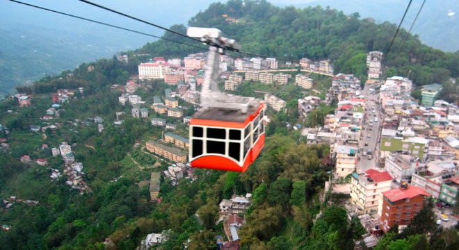
If you are at Gangtok you must visit ropeways or cable car located at Deorali market. This cable care journey is not included any local tour packages and this place can be easily reached by taking a local cab from any hotel. This rope way of about 1 km long has three entry points or stops. The lowest point is at Deorali market and the highest point is at Tashiling ( below the state secretariat ). There is a mid point stop at Nam-Nang. One can enter from any point and return to same point after touching other two points.